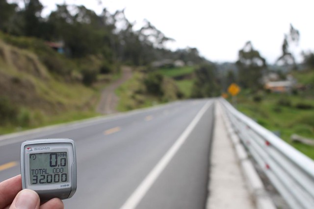
Distance: 56.27 km
Ride time: 5.17.03
Average: 10.64 km/h
Max speed: 55.34 km/h
Total: 32053 km
I was on the bike early as I knew there would be more climbing on the program today. I still haven’t managed to get hold of a map with altitudes marked, so exactly how much I needed to climb I didn’t know. What I could see on my map was that my road would pass very close to the Chimborazo volcano, Ecuador’s highest point at 6268 m. I had no illusions it would be an easy day in the office…
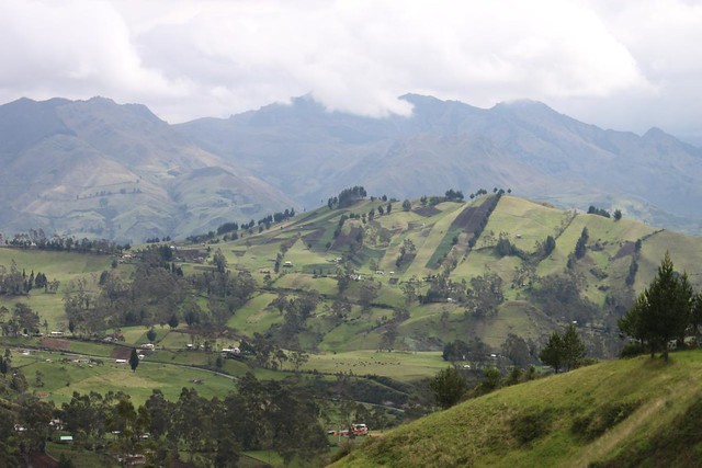
It all started gentle enough as I left Gauranda. The hills were greener than I had seen them in a long time, and it is always nice to begin the day by passing a milestone.
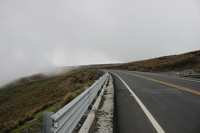
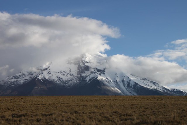
The next hours there was nothing to do but to put the head down and keep pushing those pedals around. The climb was steep, and soon the last trees disappeared. Furthermore I was in a cloud, so there really wasn’t much to see.
By the way, Ecuador easily gets the price of the best roads in South America so far. I don’t think this is the main route for crossing the Andes towards Quito, but the road has been in absolutely perfect and spotless condition since leaving Guayaquil.
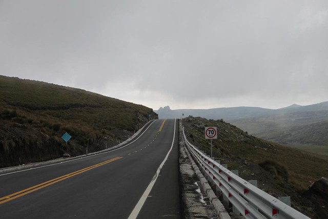
After 33 km of hard and slow cycling I reached the pass. By now I was running out of oxygen, and I was cycling with all my clothes on. In Peru they would have put a marker at the top of the pass with the altitude but that doesn’t seem to be tradition here. If anyone can tell me how high the road is, I would be interested to know 🙂
What I did find on top of the pass was a nice restaurant. I went inside and had a huge steak. The friendly restaurant owner also came over with a very strong local drink. Oh well, I was at the top of the pass so it seemed OK to celebrate.
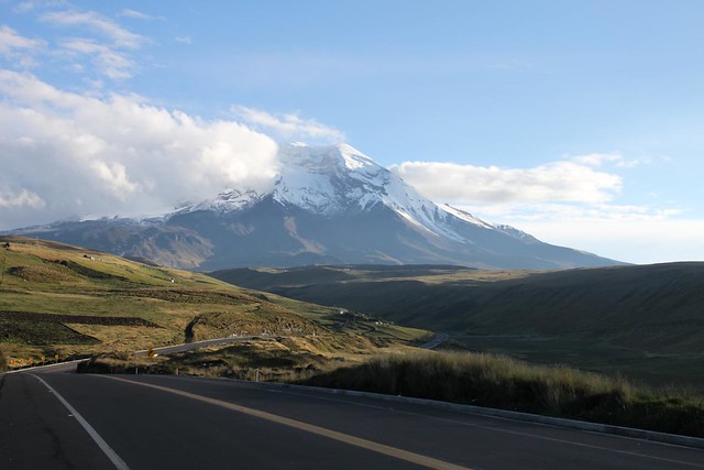
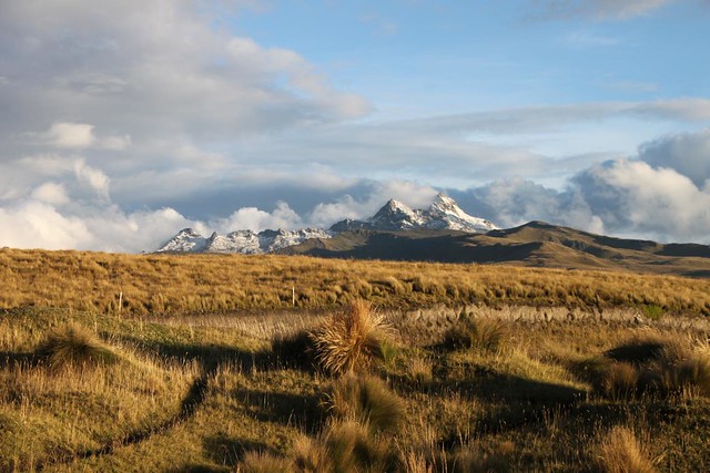
As I rolled down on the other side the clouds started to part, and I got the first amazing views of the famous Chimborazo mountain. During the climb I had been wishing I was cycling on an easy road next to the coast, but with the views I was now enjoying I wouldn’t want to be anywhere else.
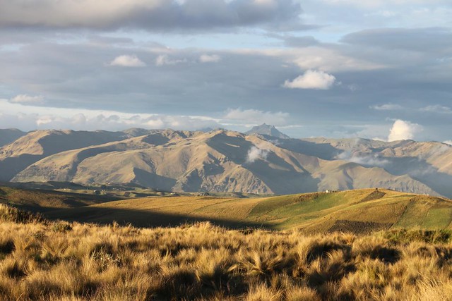
I had a couple of good reasons to continue down on the other side of the pass. Altitude wise it would have been preferable to sleep a bit lower. Furthermore I gave away most of my warm clothes and my extra sleeping bag in Peru. I knew it was going to be a cold night, but the views and the whole feeling of the place was so magic that I didn’t want to leave. Instead I turned off the road into a small path and found a perfect spot to put up the tent.


According to http://www.betzgi.ch/en/cycle-tours/andeanhighlights/passes/pass/guaranda-ambato/ it is 4200m…
Vy 73 de DL1ELY
Great research Stefan! Thanks.. and happy new year!!
I just had to guess Ambato as your destination and make the right google query. Easy ;-). Enjoy ’15.
Stefan
Thomas, I am very relieved that you were cycling with all your clothes on! Your words:
QUOTE
“By now I was running out of oxygen, and I was cycling with all my clothes on.”
UNQUOTE
Do you sometimes cycle with none of your clothes on 😉
Haha Tony… I did consider cycling across Salar de Uyuni naked but I was there in July and it was very cold, so I chickened out… Otherwise I mostly cycle with some clothes on 🙂
The altitude of the climb is 4217m. When I did the same ride five years ago I was also riding blind and had a real hard time of it that day. If you want to check out the elevation profile of the climb it’s posted on my old blog http://www.crazyguyonabike.com/doc/page/?o=Sh&page_id=141497&v=CF .
Hi Houston! Great to see the profile of the climb – looks hard on the plot, and it was hard in real life as well haha. Strange why no locals know how high the pass is… Greetings from Cali!